Ohio Public Health Advisory Alert System Announced
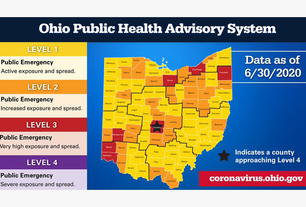
Ohio Governor Mike DeWine Thursday announced details of a new Ohio Public Health Advisory Alert System to help make clear the COVID-19 dangers happening in Ohio counties. He says the color coded system is built on data to assess COVID-19 spread and inform and empower individuals, businesses and local government in their response.
The system has four levels to provide Ohioans with guidance on the severity of the problem in the counties in which they live. The levels are determined by 7 data indicators that identify the risk level for each county and a corresponding color code to represent that risk level.
The lowest level of an alert will be yellow, or level 1 which means there are a moderate number of cases, but the virus is not spreading rapidly. Level 2 will be orange which indicates an increased risk of exposure and spread of coronavirus. Level 3 will be listed as red, which means a high risk of exposure to COVID-19. Level 3 counties should wear a mask and limit interaction with others. Level 4 is purple, which is the worst designation and means it meets all of the state’s coronavirus warnings.
Muskingum County – Yellow
Perry County – Yellow –
Coshocton County – Yellow
Guernsey County – Yellow
Noble County – Yellow
Morgan County – Yellow
Licking County – Orange
Franklin – Red