WEATHER FORECAST
Latest Forecast
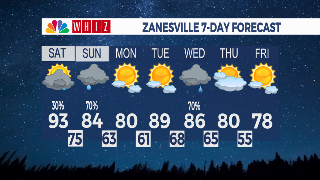
Friday Night: Mostly clear. Evening showers and storms. Low 73°
Saturday: Partly cloudy. Evening showers and storms. High 93°
Saturday Night: Mostly clear skies. Low 75°
High heat indices to persist this weekend followed by rain Sunday, cooldown begins next week: Hot and muggy conditions will persist through Saturday as temperatures remain above 90 and the added humidity drives heat indices above 100. Subsequently, a Heat Advisory for all of eastern Ohio remains in effect until Saturday at 8:00 pm.
The long-lived heat dome will be put to rest Sunday night as a cold front with a line of showers and storms approaches our doorstep, helping to cool us down to the low-80s to wrap the weekend. Mostly sunny skies and drier conditions will be the focus for the start of the work week next week as a high-pressure system moves in, which will pick temperatures back up to the upper-80s by Tuesday.
Like Sunday, another cold front will make an appearance from the northwest on Wednesday, bringing scattered showers and storms in the afternoon and evening hours. Temperatures will once again cool down to the low-80s by Thursday. A broad area of high pressure will sweep into the area Thursday, bringing intermittent sunshine and temperatures lingering around 80 the rest of the week.
Have a great evening!
Contact me!
Facebook: Meteorologist Keaton Lewis
Email: Klewis@Whizmediagroup.com