WEATHER FORECAST
Latest Forecast (Zanesville, OH):
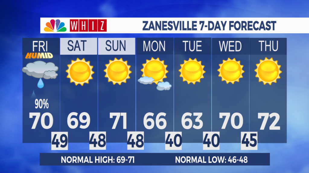
Friday: Showers, otherwise cloudy, with a high of 70. SW 5-10, becoming N, G 20-25.
Friday Night: Showers end early. Otherwise, clearing skies, with a low of 49. NE 5.
Saturday: Sunny skies, with a high of 69. NE 5-10.
Week comes to an end with some rain:
Satellite imagery is beginning to show increasing clouds around our region, which will continue to advance this morning.
The morning will start to get a bit more active as it progresses as rain begins to move into the region. This rain is associated with a cold front. Rain looks to move into our region after 9 AM, eventually moving out after 2 PM. Locally heavy rain is not out of the question, but not expecting much thunder.
Temperatures today will be cooler than yesterday, with highs into the upper 60s to around 70. Once the cold front passes, temperatures will fall and so will humidity. We are looking very pleasant this weekend as a high move back into the region. Sunny skies and near normal temperatures are expected.
Have a great day!
– Meteorologist Ashley Morgan
Contact Me!
Facebook: Meteorologist Ashley Morgan
Email: amorgan@whiznews.com