
WEATHER FORECAST
Latest Forecast (Zanesville):
Sunday Night: Partly cloudy. Calm wind. Low 69
Monday: Partly sunny. Calm wind. High 88
Monday Night: Partly cloudy. Calm wind. Low 73
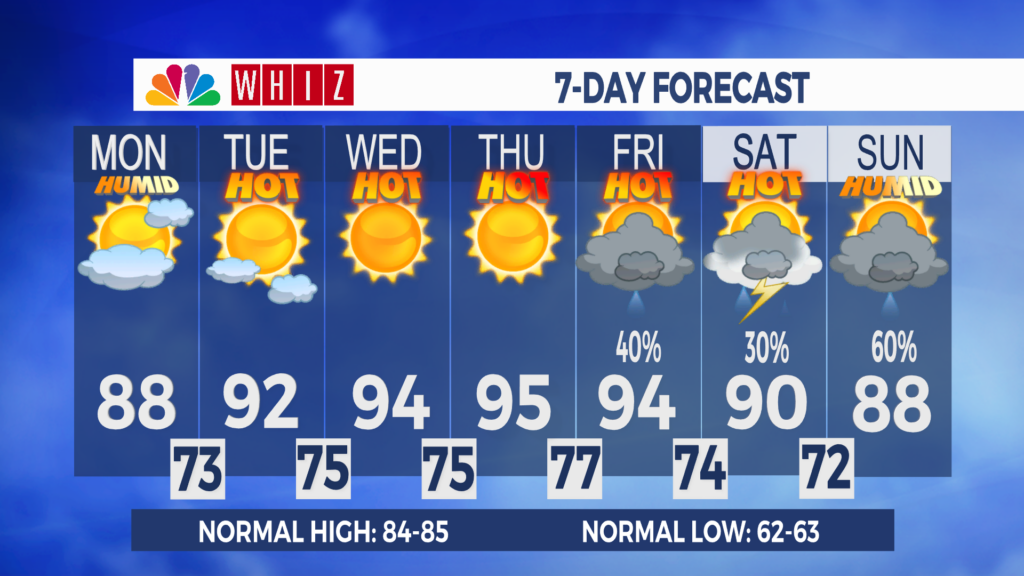
Extreme heat risk this week: Expect a couple of showers in the area this afternoon and evening as a boundary stalls over the Ohio Valley.
The heat and humidity crank up this week as the front moves back north and a heat ridge builds over the Eastern United States. High temperatures will climb into the 90s, with apparent temperatures exceeding 100. Nighttime lows will be in the 70s, offering little to no relief. Make sure to drink lots of water, take frequent breaks, and check on your friends, family, and neighbors.
There are some indications that the heat will lessen slightly, and rain and storm chances will return late in the week into the Holiday weekend as the heat ridge weakens. The forecast can change since we’re days away, so be sure to check back in for updates!
Have a great day!
-Chief Meteorologist Keaton Lewis
Contact Me!
Facebook: Meteorologist Keaton Lewis
Instagram: keatonlewiswx
Email: klewis@whiznews.com
Forecast
The WHIZ Weather Team
