WEATHER FORECAST
Latest Forecast:
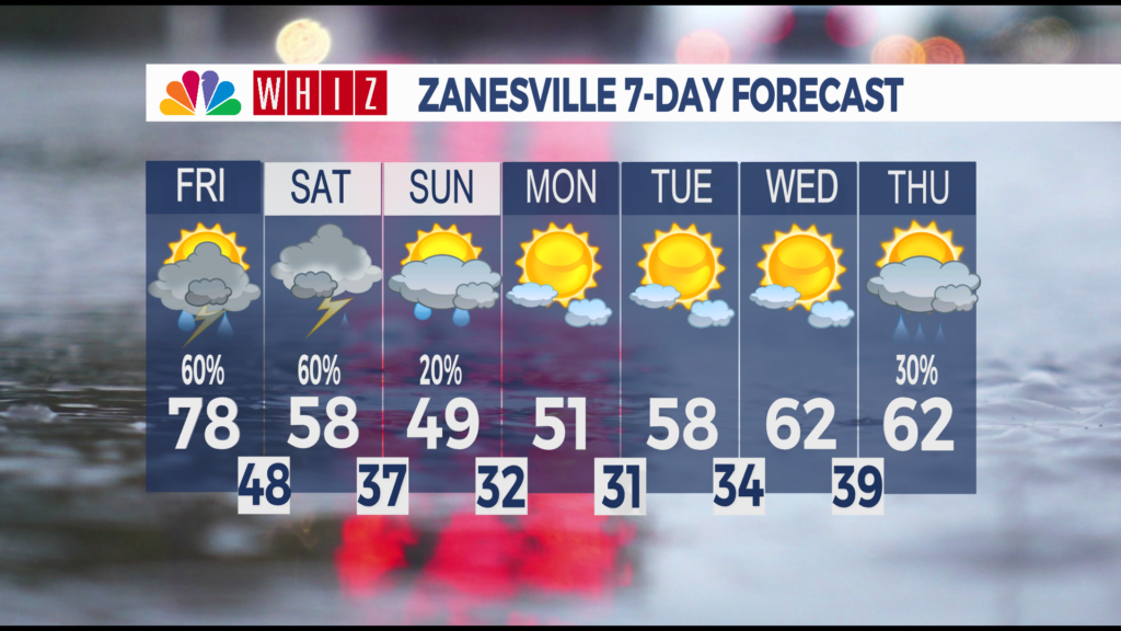
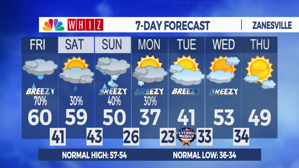
Friday: Cloudy and breezy. Afternoon and evening showers. High 60
Friday Night: Decreasing clouds then fog. Low 41
Saturday: Fog then increasing clouds. High 59
Umbrellas needed Friday. First snowflakes this weekend: A Great Lakes system will bring wind and rain to the area on Friday. The rain will move in at lunchtime and taper off around dinnertime, with totals up to half an inch. A southwest wind will gust up to 30 mph, and will boost highs to the low 60s.
Fog is expected late tonight and early Saturday morning as clouds decrease and winds relax overnight.
After a foggy Saturday morning, the rest of the day will be quiet and mild, with highs around 60. Rain chances will return late Saturday night from our next weather system.
Rain will continue falling intermittently, then switch to snow at night on Sunday as temperatures cool throughout the day. By late night, temperatures will be down in the mid-20s.
Some snowflakes throughout the day on Monday as lake-effect moisture taps into the region. Highs will be in the mid-30s, the coldest since early March. Models suggest up to a half-inch of snow accumulation across the area, but it won’t stick around long due to above-freezing highs and lows for the rest of the extended forecast.
Have a great day!
Contact me!
Facebook: Meteorologist Keaton Lewis
Email: klewis@Whizmediagroup.com