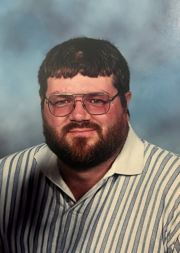
Jonathan “Jon” Stottsberry

Jonathan (Jon) Stottsberry, born March 5, 1958, passed away on June 17th at the age of 68.
A 1976 graduate of Maysville High School and Muskingum Area Joint Vocational School in Business Ag, Jon dedicated much of his life to both his profession and his community. He spent more than 30 years working in construction and masonry, building not only structures but lasting relationships through his craftsmanship and work ethic. Later, he became co-owner of Mid Ohio Title Agency, where he worked until his retirement in 2023.
Jon was a member of Duncan Falls Baptist Church and was deeply involved in several organizations that reflected his passions and commitment to service. He served as President of the Central Ohio Chapter of the GTO Association of America and was a Past President of the General Rufus Putnam Chapter of the Ohio Society of the Sons of the American Revolution in Zanesville.
Following retirement, Jon embraced a wide variety of interests and hobbies. He was a devoted classic and muscle car enthusiast who enjoyed sharing his knowledge and passion with fellow enthusiasts. He also found great enjoyment in photography, woodworking, horticulture, and tackling any challenge that sparked his curiosity. Whether restoring, building, growing, or learning, Jon approached life with enthusiasm, determination, and an appreciation for detail and craftsmanship.
Jon will be remembered for his strong work ethic, love of family and friends, dedication to his community, and the countless lives he touched through his knowledge, and willingness to lend a helping hand.
He is survived by his brothers Dan Stottsberry, Tim Stottsberry and Dave Stottsberry, Sister Becky Fisher, children Eric (Christy) Stottsberry, Ashley (Josh) Becker, grandchildren, Carson Stottsberry, Carley Becker and Evan Becker, great-grandchildren, Jameson McKee and Koah Stottsberry; numerous nieces, nephews and friends.
He was preceded in death by his wife of 46 years Jackie Deanne Stottsberry, parents Charles and Lois (Benson) Stottsberry, brother Don Stottsberry, sisters Linda Pokrywki, Priscilla Hartfield, and granddaughter Makayla Stottsberry.
Visitation will be from 5:00 PM to 7:00 PM on Wednesday, June 24th with funeral service at 11:00 AM Thursday, June 25th at Bryan & Hardwick Funeral Home. Burial will conclude at the Zanesville Memorial Park Cemetery.
In lieu of flowers, the family requests donations be made to the Ross Heart Hospital at OSU, Christ Table or Eastside Ministry in Jon’s memory.
The Bryan & Hardwick Funeral Home, 2318 Maple Ave. Zanesville, is in charge of the arrangements. To share memories and condolences with Jon’s family please visit www.BryanHardwickFH.com.